Synopsis:
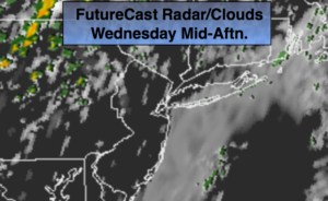
A Southerly flow will keep the humidity high today. A spot shower or storm is possible. The majority of the day will be dry. Enough drying may occur for some sun from time to time. A cool front will approach during the evening with scattered showers and possibly a thunderstorm.
Seasonal conditions are expected for the end of the week. A few morning showers are possible Friday, otherwise it should be fair.
The weekend looks bright with pleasant temperatures.
You know where to find a no hype, no nonsense forecast.
Stay tuned.
Today:
Clouds, some peeks of sun, warm and humid. A spot shower can’t be ruled out. The majority of the day will be dry. Scattered showers and a thunderstorm is possible during the evening. Highs near 80º. South winds at 8-12mph.
Tonight:
Scattered showers and storms this evening, otherwise mostly cloudy. Becoming much less humid by morning. Lows around 60º in the City, the 50s inland. Northwest winds 8-12mph.
Thursday:
Partly sunny. Highs in the lower 70s.
Friday:
Scattered morning showers, otherwise a mix of clouds and sun. Highs in the lower 70s.
Saturday:
Mostly sunny. Highs in the lower to mid 70s.
Sunday:
Sunny, cooler. Highs in the upper 60s.
Keep it here for a no nonsense, no hype forecast.