Synopsis:
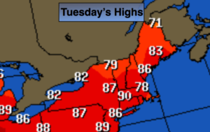
The shortened workweek forecast looks a unsettled. Clouds will give way to some sun today. It’ll be warm and humid with readings well into the 80s. A cool front will move into the region tonight. A spot storm can’t be ruled out overnight.
Wednesday starts off with clouds and possibly some drizzle with the flow off the ocean. It’ll be much cooler. The sun will make an appearance during the afternoon.
An area of low pressure and it’s associated fronts will move over the Northeast Thursday through Saturday. The system will be a slow mover. Showers are possible just about anytime as we turn the calendar to June. It will not be a washout.
Stay tuned.
Today:
Morning clouds will give way to partly sunny skies. It’ll be warm and humid. Highs in the mid 80s. West to Southeast winds at 5mph.
Tonight:
Cloudy with patchy fog. Areas of drizzle developing. A spot storm is possible. Lows in the 60s throughout. Southeast to East winds less than 5mph.
Wednesday:
Morning clouds, patchy fog and drizzle with give way to some sun. Cooler. Highs in the mid 70s.
Thursday:
Mostly cloudy. Chance of showers. Highs in the lower to mid 70s.
Friday:
More clouds than sun. Scattered showers and storms. Highs near 80º.
Saturday:
More clouds than sun. Chance of showers. Highs in the 70s.
Keep it here for a no nonsense, no hype forecast.