Synopsis:
A stationary front over the Mid-Atlantic will affect our weather through the workweek. Clouds, areas of fog and drizzle can be will be with us this morning. The sun should make an appearance this afternoon. Temperatures should feel more like mid-May.
A Southerly flow will develop on Tuesday along with more sunshine. This will result warm and humid conditions. Energy riding along the stationary front will cause showers and strong to severe thunderstorms to develop later in the day and night. Flash flooding is a possibility as well, as the models are hinting at slowly recurring storms.
Wednesday and Thursday should be drier with highs just above the average of 71º.
The stationary front will become a strong warm front and move toward the area on Friday. The ingredients are there for the potential of more heavy rain and thunderstorms later in the day.
Stay tuned.
Today:
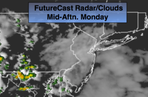
Early drizzle and clouds giving way to some afternoon sun. Highs around 70º. Northeast to South winds at 5-1omph.
Tonight:
Mostly cloudy with spotty showers and thunderstorms. Many areas will remain rain-free. Much warmer than recent nights. Lows in the lower 60s throughout. Light South wind.
Tuesday:
Sun and clouds, warmer and more humid. Scattered afternoon thunderstorms. Highs in the 80s.
Wednesday:
Mostly cloudy. Spot shower. Highs in the mid 70s.
Thursday:
Clouds to some sun. Highs in the mid 70s.
Friday:
Cloudy with periods of rain and thunderstorms. Highs in the mid 70s.
Keep it here for a no nonsense, no hype forecast.