Synopsis:
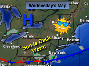
High pressure will build into the area Today and Thursday. Skies will be mainly sunny with warm temperatures. A couple of mid-August gems are on the way.
On Friday a low pressure system will work into the Northeast and increase the threat for scattered showers and spotty storms. The trough should move offshore Saturday with morning showers giving way to sunshine. Sunday looks spectacular.
Hurricane Gert is moving Northeast farther offshore of the US mainland. A storm for the fish and shipping lanes. Life threatening rip currents are likely along our coast. Please swim at guarded beaches.
Stay Tuned.
Today:
Patchy morning fog otherwise mostly sunny and much warmer. Highs in the upper 80s. Northwest winds at 5-10mph.
Tonight:
Clear skies. Lows in the upper 60s in the City, the 50s inland. North winds at 5mph.
Thursday:
Partly sunny. Highs in the lower to mid 80s.
Friday:
Mostly cloudy with scattered showers and spotty storms. Humid. Highs in the lower 80s.
Saturday:
Scattered morning showers, otherwise becoming partly sunny. Highs in the mid 80s.
Sunday:
Sunny and warm. Highs in the mid 80s.
Keep it here for a no nonsense, no hype forecast.