Synopsis:
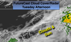
Today will feature a mix of sun and clouds. A weak low to the South will move up and off the coast later today and tonight. A bit of light rain may work into the area mainly to the South and East of I-95 later today and tonight. This is only a slight chance.
Wednesday will be dry and warm as we’ll be in between systems. An unsettled period is likely Thursday into Friday as a low pressure system affects the area. Occasional rain is likely Thursday. Spotty showers are possible Friday. There will be dry times.
The beginning of the Memorial Day Weekend looks decent with sunshine and warm readings on Saturday. Actually, Saturday looks like the best day of the three. The shower threat returns later Sunday and into Memorial Day. The forecast of showers for later in the holiday weekend is not etched in stone whatsoever.
Stay tuned.
Today:
Some sun, otherwise becoming mostly cloudy. Warmer. A slight chance of light rain along the coast later in the day. Highs in the mid 70s. Southeast to North winds at 5-10mph.
Tonight:
A slight chance of showers otherwise mostly cloudy. Lows around 60º in the City, near 50º inland. South to North winds at 5-10mph.
Wednesday:
Mostly sunny. Highs in the mid 70s.
Thursday:
Occasional rain. Highs in the mid to upper 60s.
Friday:
Mostly cloudy. Scattered showers. Highs in the near 70º.
Saturday:
Partly sunny and mild. Highs in the mid 70s.
Keep it here for a no nonsense, no hype forecast.