Synopsis:
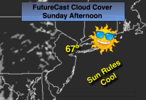
High pressure will continue to push in from Eastern Canada today. This will result in a beautiful Sunday. Readings will be several degrees below average.
A front will move into the area on Monday with periods of rain. A brief break in the wet weather will occur Tuesday. An unsettled period is likely Wednesday and Thursday as an upper level low works into the region with a couple chances of showers.
Stay tuned.
Today:
Partly sunny, cool. Highs in the mid to upper 60s. East to Southeast winds at 10-15mph.
Tonight:
Becoming cloudy. Showers possible toward sunrise. Lows in the mid 50s in the City, near 50º inland. Southeast winds at 5-10mph.
Monday:
Periods of rain, cool. Highs in the mid 60s.
Tuesday:
Partly sunny. Seasonal. Highs in the mid 70s.
Wednesday:
Mostly cloudy with scattered showers. Highs in the upper 60s.
Thursday:
Mostly cloudy with scattered showers. Highs in the near 70º.
Keep it here for a no nonsense, no hype forecast.