Synopsis:
A warm bubble of high pressure continues to sit over the Northeast. It will be Summer-like today for this first full day of fall. A significant cool front will arrive late tonight and Saturday morning. The front if moisture starved and will mostly likely come through with just some spotty showers. There will be a noticeable change in the airmass with readings at least fifteen degrees cooler on Saturday. Sunday will be sunny with a nip in the air-Fall has arrived.
Today:
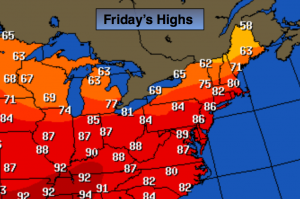
Partly sunny and very warm with readings in the mid to upper 80s. Southwest wind at 8-12mph.
Tonight:
Mostly cloudy with a stray showers possible. Lows in the mid 60s in the City, the mid 50s inland. Winds becoming North at 10-15mph.
Saturday:
Mostly sunny and much cooler with highs in the lower 70s.
Sunday:
Sunny with below average temperatures. Highs in the upper 60s.
Monday:
Sunny. Highs around 70º.
Tuesday:
Sun and clouds with showers possible. Highs in the lower 70s.
Stay Tuned.
Keep it here for a no nonsense, no hype forecast.