Synopsis:
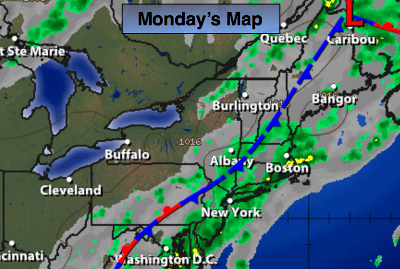
A trough in the upper levels of the atmosphere will pivot through the area today. At the same time a deep tropical moisture laden airmass will be in the place. The combination of the two will cause a period of heavier and steadier rain this morning, not all areas will receive heavy rain. Where the heavy rain axis sets up an inch or more of rainfall is possible. The last time over a half inch of rain fell, and this occurred only for a few areas, was around the August 20th date. The last widespread heavy rain event that included the entire area was the last two days of July!
There should be a break in the action during the afternoon, especially over the Western half of the tri-state. By later in the day stray storms are possible. The system will swing off the coast as high pressure works in for the remaining days of Summer. Autumn arrives on Thursday.
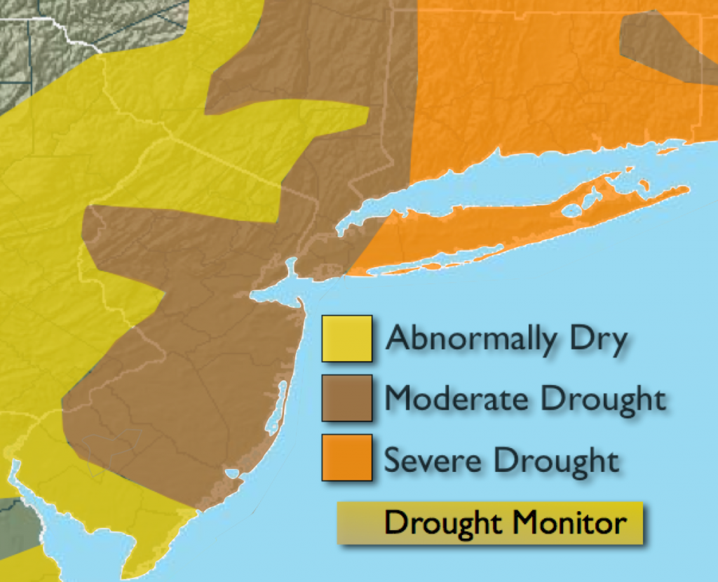
The drought situation continues to worsen. Most areas are in a moderate to severe drought. The rainfall deficit for the year ranges from five to ten inches, with the highest deficit being over Long Island and parts of Connecticut. If the heavy rain materializes it would help the immediate dry conditions but it won’t alleviate the drought conditions. I guess every bit helps.
Today:
A period of heavy rain and scattered thunderstorms are possible in the morning, otherwise mostly cloudy and humid with stray afternoon showers. Highs in the upper 70s. South to Northeast winds at 5-10mph.
Tonight:
Cloudy and muggy with scattered showers. Lows near 70º in the City, near 60º inland. Light and variable winds.
Tuesday:
Partly sunny. Highs in the lower 80s.
Wednesday:
Sunny and warm with readings in the lower to mid 80s.
Thursday:
Sunny with highs around 80º.
Friday:
Partly sunny with highs in the lower 80s.
Stay Tuned.
Keep it here for a no nonsense, no hype forecast.