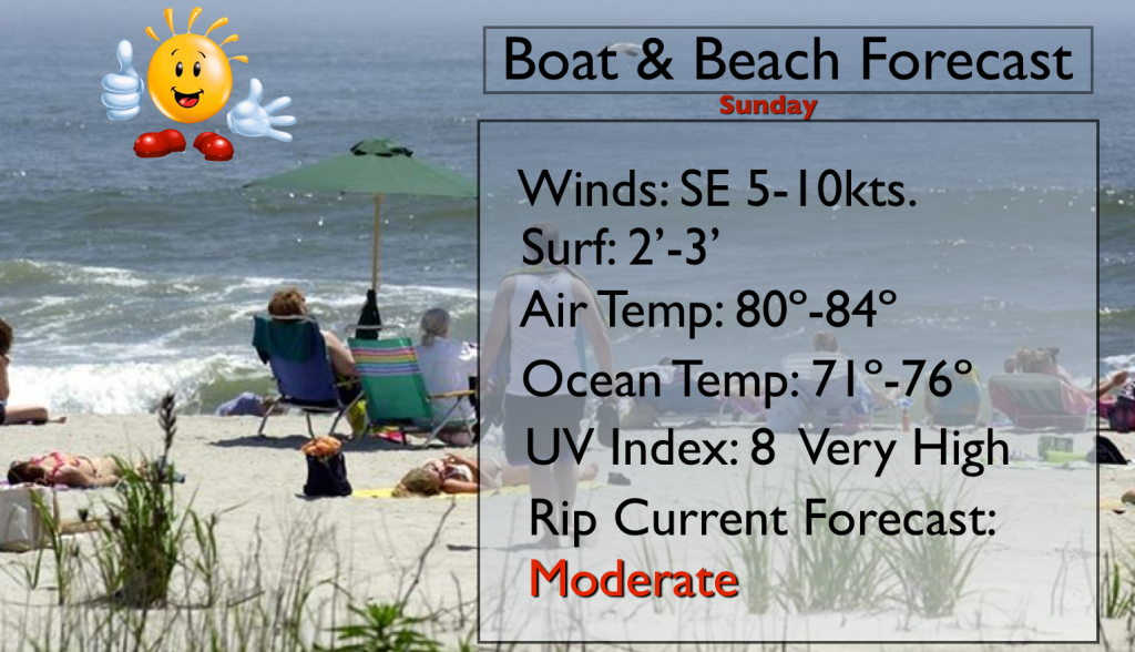
Synopsis:
High pressure will continue to influence our area today. This last weekend of August will be one to remember. Wall to wall sunshine with low humidity is again expected today. We’ve been very dry the last several days and this dry pattern looks to continue well into next week with high pressure in control.
A cool front will move in Wednesday night with showers and possible storms. A refreshing airmass will move in late week.
Now to the tropics. There is a weak disturbance nearing Florida. The ingredients haven’t come together for a tropical storm to form. We’ll continue to monitor the progress of this system as it continues West/Northwest. This system may meander over the Eastern Gulf of Mexico for a few days. Please stay tuned to this site as the next 10-15 days may become highly active.
Today:
Sunny and warm. Highs in the mid 80s. Southeast winds at 8-12mph.
Tonight:
Clear. Lows in the lower 70s in the City, the lower 60s well inland. South wind at less than 5mph.
Monday:
Mostly sunny and hot. Highs near 90º.
Tuesday:
Mostly sunny. Highs in the mid 80s.
Wednesday:
Mostly sunny. Highs in the upper 80s.
Thursday:
Mostly sunny and breezy. Much less humid. Highs in the lower 80s.
Stay Tuned.
Keep it here for a no nonsense, no hype forecast.