Synopsis:
High pressure has been the main weather feature this week. The high will slip off the coast and become a heat and humidity pump for today. A front (more like a humidity buster) will move through later today setting the stage for a memorable last weekend of August. We’ve been very dry the last five days and this dry pattern looks to continue well into next week with high pressure in control.
Now to the tropics. There is a low in the Bahamas. The ingredients haven’t come together for a tropical storm to form.We’ll continue to monitor the progress of this system as it continues West/Northwest through the Bahamas. I’m not expecting development in the near future.
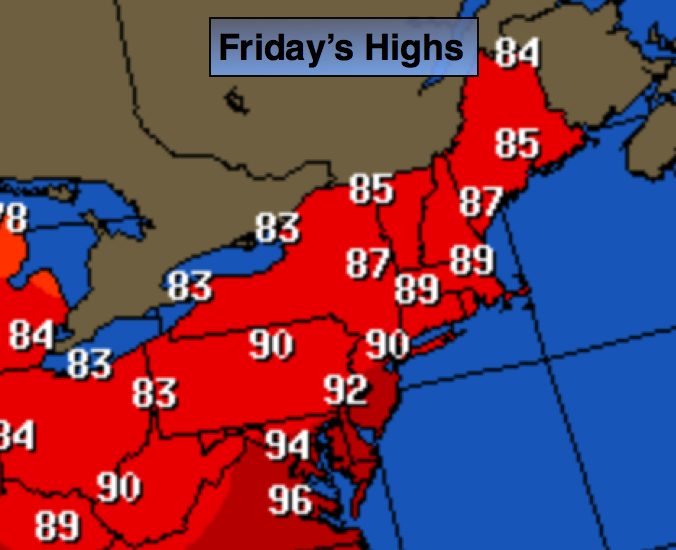
Today:
Hazy, hot and humid with highs in the lower 90s. The humidity will lower some during the mid to late afternoon. Southwest wind will become Northwest at 10-15mph.
Tonight:
Clear and less humid. Lows in the lower 70s in the City, around 60º well inland. Northwest to North wind at 5-10mph.
Saturday:
Mostly sunny, very warm and less humid. Highs in the mid to upper 80s.
Sunday:
Mostly sunny. Highs in the mid to upper 80s.
Monday:
Mostly sunny. Highs in the mid to upper 80s.
Tuesday:
Mostly sunny. Highs in the mid to upper 80s.
Stay Tuned.
Keep it here for a no nonsense, no hype forecast.