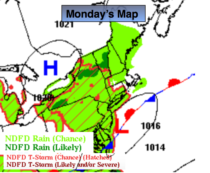
Synopsis:
The weak low pressure over the Mid-Atlantic combined with a very humid and saturated airmass will cause scattered showers and thunderstorms today. There will be several hours of dry time. Pockets of torrential rain is possible. Please use caution. If you encounter a flooded roadway- TURN AROUND, DON’T DROWN.
High pressure will finally move in from the West and dry us out for Tuesday. Nice conditions are expected through Friday. Some decent weather is on the way for the beginning of August-meaning no heat wave.
Today:
More clouds than sun. Humid. The shower and thunderstorm threat remains. Highs will be around 80º. Torrential rain is possible at times. East/Northeast wind at 5-10mph.
Tonight:
Scattered showers and thunderstorms. Some of the rain could be heavy at times. Muggy. Lows around 70º in the city, mid 60s inland. Northeast wind less than 5mph.
Tuesday:
Mostly sunny with readings in the lower 80s.
Wednesday:
Sunny with highs in the lower 80s.
Thursday:
Sunny and warm with highs in the mid 80s.
Friday:
Hazy and very warm with reading in the upper 80s.
Stay Tuned.
Keep it here for a no nonsense, no hype forecast.