Synopsis:
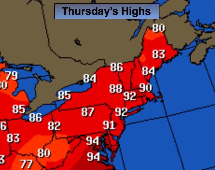
The heat wave will continue for one more day as the heat dome over the Mid-Atlantic weakens. Today will be day 8 of the heat wave for most areas and our stretch of 90º+ will end on Friday. It’s about time.
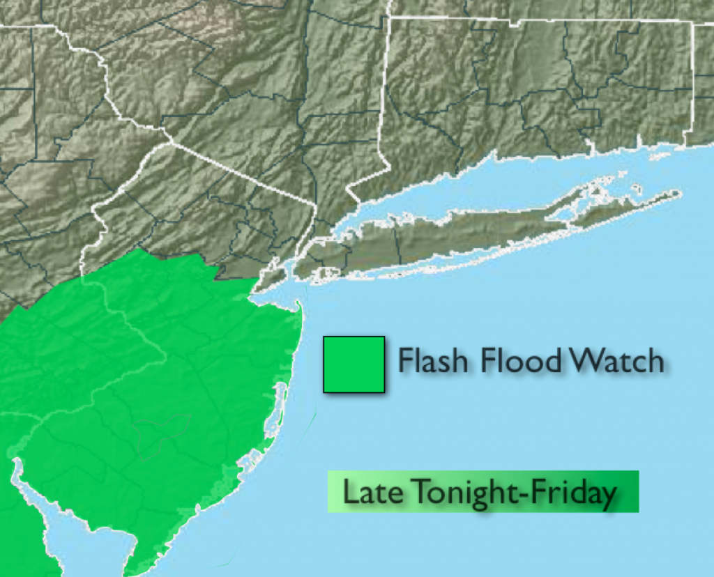
An area of low pressure on Friday will give the area a decent shot of rain and storms with cooler readings. A Flash Flood Watch has been posted for Central and Southern NJ for the threat of heavy rain on Friday Morning that could lead to flooding. The steadiest rain will move out of the area around Mid-day.
The better half of the weekend looks to be Saturday as another weak low may give the region showers and storms on Sunday. Sunday’s forecast isn’t clear cut at this time it could be rain-free. Stay tuned.
Today:
Partly sunny, hot and more humid. A stray storm is possible later in the day. Most areas will be storm-free.. Highs once again will be around 90º. This will be the last day of this current heat wave. Southeast wind at 5-10mph with higher gusts.
Tonight:
Cloudy with rain and thunderstorms developing toward Midnight. The rain could be heavy at times. Southeast wind at 5mph.
Friday:
Periods of rain and thunderstorms. The rain could be heavy at times in the morning. Much cooler with highs only in the lower 80s.
Saturday:
Hazy, very warm and humid. It should remain storm-free. Highs in the mid to upper 80s.
Sunday:
Hazy, warm and humid with the chance of scattered storms. Highs in the mid 80s.
Monday:
Clouds will give way to sun with readings in the lower 80s.
Keep it here for a no nonsense, no hype forecast.