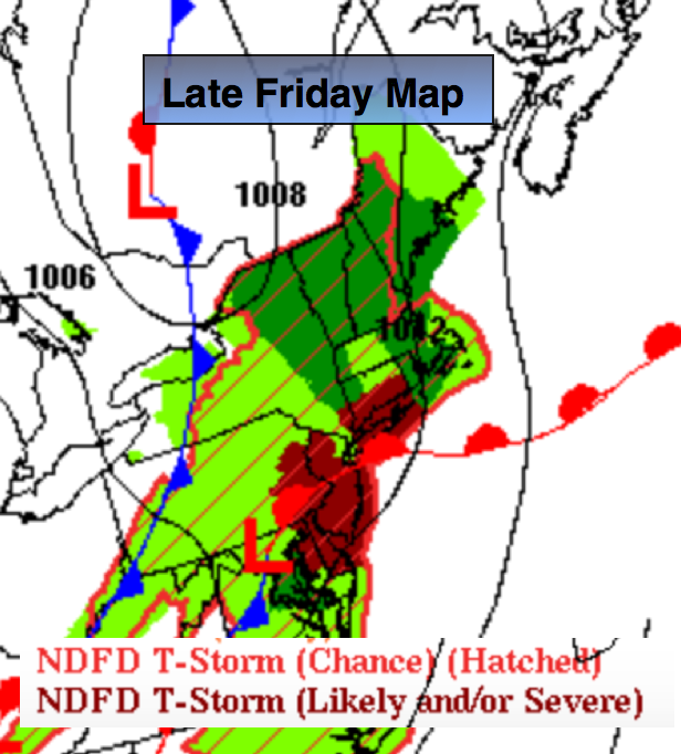
Synopsis:
A disturbance in the upper levels of the atmosphere combined with an approaching weak cool front will spark off scattered storms by mid-day Friday into Friday evening. Some of the thunderstorms may turn severe especially from the NYC area and to the West. Severe storms contain either of the following: winds in excess of 58mph and or 3/4″ hail. Keep an eye to the sky for threatening weather from 1pm to 9pm. The storms will develop over Northwestern areas first and then move toward the coast.
The July 4th weekend looks like a winner with high pressure rebuilding into the area.
Today:
Some morning sunshine, otherwise mostly cloudy and humid. Scattered thunderstorms will develop during the afternoon and the threat will remain through the evening Highs in the lower 80s. Southeast to South wind at 10-20mph.
Tonight:
Scattered evening storms, otherwise partly cloudy and becoming less humid by sunrise. Lows in the upper 60s in the City, the upper 50s inland. Southwest to Northwest wind at 5-10mph.
Saturday:
Mostly sunny with low humidity. Highs will be in the lower to mid 80s.
Sunday:
Mostly sunny with highs in the mid 80s.
July 4th (Monday):
Mostly sunny. Readings will be in the mid 80s.
Tuesday:
Partly sunny. Showers may skirt southern regions. Highs in the lower to mid 80s.
Stay Tuned.
Keep it here for a no nonsense, no hype forecast.