Synopsis:
Cooler sunshine will greet us today courtesy of high pressure from Eastern Canada. Readings will be five to seven degrees below the average high of 57º.
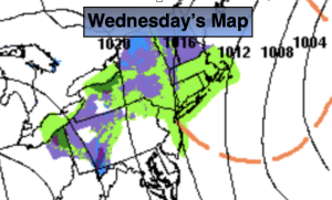
Skies will be grey on Thursday as a weak low moves through the Mid-Atlantic. A spotty shower is possible along with a peek of sun.
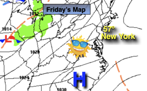
The week should close on a dry note on Friday with high pressure moving in from the West. More clouds than sun is expected.
Veterans’ Day on Saturday will be cool but bright. We thank those that have kept our freedom alive! There’ll be a nip in the air on Sunday as Canadian high pressure settles over the area.
Stay tuned.
Keep it here for a no nonsense, no hype forecast.
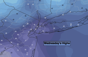
Wednesday:
Mostly sunny. Cooler. Highs in the lower 50s. Northwest winds at 10-15mph and diminishing.
Tonight:
Becoming mostly cloudy. Lows in the mid 40s along the urban corridor, the 30s inland. Northeast to Southeast winds at 5mph.
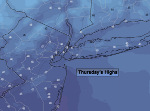
Thursday:
Mostly cloudy. Spotty shower possible along with a peeks of sun. Highs in the upper 50s.
Friday:
Clouds, some sun. Highs in the mid 50s.
Veterans’ Day:
Mostly sunny. Highs in the lower to mid 50s.
Sunday:
Sunny. Chilly. Highs in the upper 40s.