Synopsis:
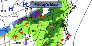
Welcome to December. Any early morning sun will give way to thickening clouds. Rain will work in from West to East this afternoon ahead of a front approaching from the West. Readings will be just above the average high of 49º. The rain will taper off later this evening.
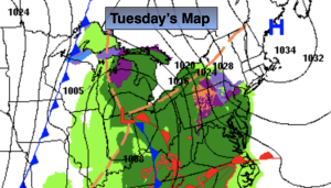
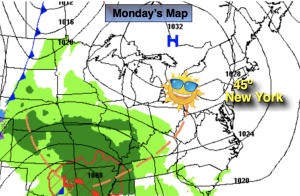
The first weekend of December looks a bit unsettled with weak low pressure systems moving thorough the Eastern states. Saturday looks dry under mostly cloudy skies. Sunday will most likely be wet at times as a low works through the region. Readings will be near average.
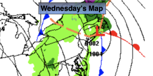
Low pressure will wind up over the Canadian Maritimes early next week. Dry, chilly conditions are expected with a gusty wind on Monday and Tuesday.
Stay tuned.
Keep it here for a no nonsense, no hype forecast.
Friday:
Any early morning sun giving way to clouds and afternoon rain. Highs in the lower 50s. Southwest to South winds at 5-10mph.
Tonight:
Areas of rain tapering off. Lows in the mid 40s along the urban corridor, the 30s inland. Southwest winds at 5mph.
Saturday:
Mostly cloudy. Highs in the mid 50s.
Sunday:
Mostly cloudy. Chance of showers. Highs in the lower 50s.
Monday:
Partly sunny. Highs around 50º.
Tuesday:
Partly sunny. Cooler. Highs in the mid 40s.