Synopsis:
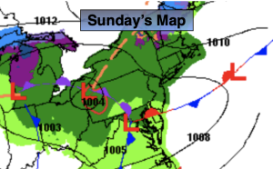
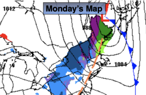
Low pressure South of Long Island Monday morning will move over Eastern New England today. Cold air will be wrapping around on the Western side of the storm. Any early morning rain could change over to a period of wet snow North and West. A slushy coating is possible over parts Sussex and Orange counties. All of the precipitation will come to an end by mid morning. We’ll dry out with sunshine and gusty winds later in the morning and afternoon.
Tuesday thorough Thursday will feature abundant sunshine and chilly readings as high pressure settles over the Eastern states.
It’ll be a better feel by Friday as a southwest wind develops around the area of high pressure.
Stay tuned.
Keep it here for a no nonsense, no hype forecast.
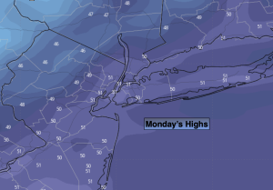
Monday:
Early morning rain. Rain or wet snow inland. Becoming sunny later in the morning. Windy. Highs in the mid 40s. Northwest winds at 15-30mph with gusts to 40mph.
Tonight:
Clear. Lows in the lower 30s in the City, the 20s inland. Northwest to West winds at 10-20mph- diminishing to 5-10mph
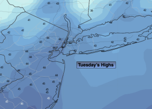
Tuesday:
Sunny. Cool. Highs in the mid 40s.
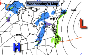
Wednesday:
Mostly sunny. Highs in the lower to mid 40s.
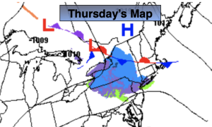
Thursday:
Sunny. Highs around 40º.
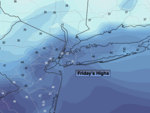
Friday:
Sunny. Milder. Highs around 50º.