Synopsis:
Today will start off with clouds but the sun will return by afternoon. It’ll be milder as high pressure over the Southeast pumps up a Southwesterly flow.
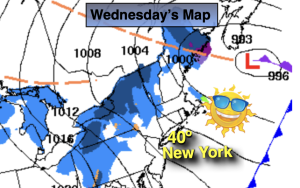
On Wednesday a stationary front over the region will result in cloudy skies with on and off showers.
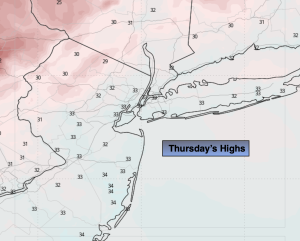
A mix of clouds and sun is expected on Thursday along with seasonal readings.
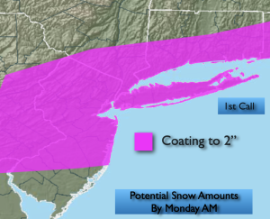
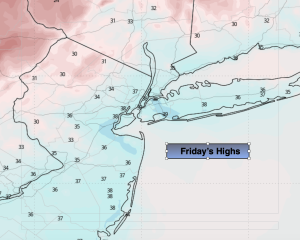
Friday will be unsettled as weak low pressure scoots to our South. Some rain is likely. A potential mix exists for Northern areas.
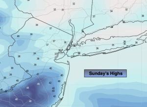
Clouds will continue to dominate on Saturday as weather systems remain weak over the region.
Keep it here for a no nonsense, no hype forecast…
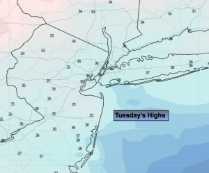
Tuesday:
Clouds to sun. Milder. Highs in the mid 40s to around 50º. Southwest to West winds at 5-10mph.
Tonight:
Mostly cloudy. Lows in the mid 30s along the coast, near freezing inland. West winds at 5mph.
Wednesday:
Mostly cloudy. Scattered showers. Highs in the lower 40s.
Thursday:
Mostly cloudy. Highs in the lower to mid 40s.
Friday:
Areas of rain. A mix possible North & West. Highs around 40º.
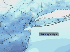
Saturday:
Mostly cloudy. Highs in the lower 40s.