Synopsis
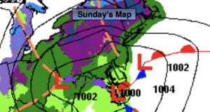
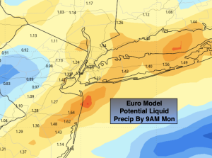
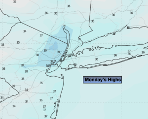
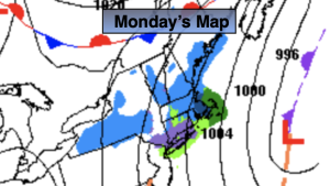
Low pressure off the NJ coast will move slowly out to sea tonight and Monday. Intermittent light rain will fall in most areas overnight. The rain has the potential to change over to wet snow well North and West of the City as some cold air gets wrapped into the system. There is a potential of some accumulation well inland by Monday morning. At this time, a coating of snow is possible. There is only marginally cold air available and no true influx of Canadian air. For this reason the City and coast should be predominantly rain. As the low intensifies off the Southern New England coast Monday a band of light rain mixed with wet snow may develop by the coast. No accumulation is expected. The sun may say hello later in the day. There’ll be a gusty North wind.
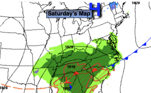
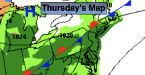
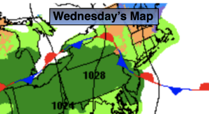
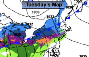
Seasonable temperatures are expected for Tuesday and Wednesday as high pressure sits over the region. The sun will dominate. We’ll go above average with the mercury on Thursday as the lack of Arctic air continues as we turn the page to February. On Friday, Groundhog Day, a cold front will approach. Scattered rain or snow showers are possible. Much of the time it will be dry.
Keep it here for a no nonsense, no hype forecast.
Tonight:
Intermittent light rain. Mix of rain or wet snow well North and West. Breezy. Lows in the 30s throughout. North winds at 10-20mph with gusts to 30mph.
Monday:
Scattered rain and or snow showers. Peek of late day sun. Breezy. Highs in the lower 40s. North winds at 10-20mph.
Tuesday:
Partly sunny. Highs in the upper 30s.
Wednesday:
Mostly sunny. Highs in the upper 30s.
Thursday:
Partly sunny. Highs in the mid 40s.
Friday:
Clouds and sun. Scattered rain or snow showers. Highs in the lower 40s.