Synopsis:
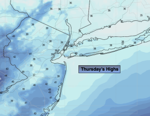
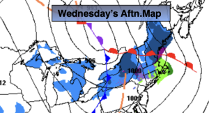
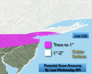
A stationary front will be South of the area today. Periods of rain are likely. Southern sections will be on the fridge of the steady rain just a few showers are likely here. Rain will continue tonight.
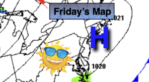
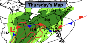
It’ll still be unsettled Friday as low pressure moves off the coast. A moist Northeast flow will remain. Cloudy skies are expected. Spotty drizzle is possible.
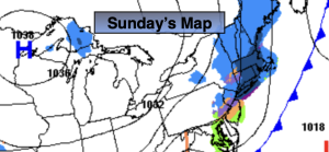
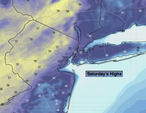
On Saturday a Southwest wind should prevail around a Western Atlantic high. This should result in a boost in temperatures. A cool front will move through Saturday night with a few showers. Sunday will feature a mix of sun and clouds along with mild readings. Mild conditions will continue into Monday with high pressure off the Southeast coast.
We “Spring Ahead” this Sunday. Set the clocks ahead one hour Sunday at 2am as Daylight Saving Time begins. The sun will set an hour later. Yes! It’s also a good time to check the batteries in your smoke and carbon monoxide detectors.
Stay tuned.
Keep it here for a no nonsense, no hype forecast…
Thursday:
Periods of rain. Highs in the lower 40s. Northeast winds at 5-10mph .
Tonight:
Periods of rain. Lows in the 30s throughout. Northeast winds 8-15mph.
Friday:
Cloudy with spotty drizzle. Highs in the lower 40s.
Saturday:
Clouds, some sun. Milder. Highs in the upper 50s.
Sunday:
Becoming party sunny. Mild. Highs around 60º. Warmer inland, cooler at the coast.
Monday:
Mostly sunny. Mild. Highs around 60º. Warmer inland, cooler at the coast.