Synopsis:
Summer arrived early this morning at 12:24EDT. That’s when the sun’s direct rays was over the Tropic of Cancer. The greatest amount of daylight of the year is experienced today.
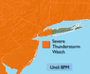
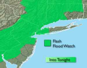
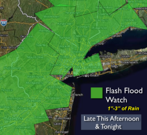
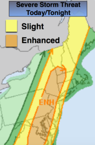
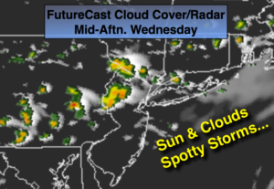
It’ll be comfortable with a mix of sun and clouds today. Spotty storms are possible laster this afternoon as a weak disturbance works through (FutureCast Radar above).
Thursday will be a gem as high pressure dominates.
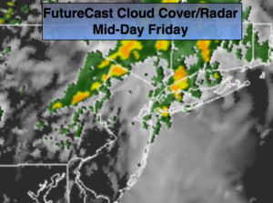
Humidity and the threat of storms returns Friday as a moist Southerly flow develops.
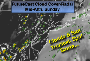
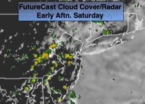
The weekend at this point looks decent with a mix of sun and clouds and seasonal readings. An early shower is possible Saturday otherwise it’ll be dry.
Stay tuned.
Today:
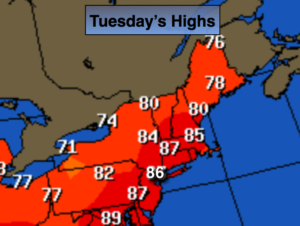
Sun and clouds. Spotty afternoon and evening storms. Breezy. Highs in the mid 80s. West/Southwest winds at 10-20mph with gusts to 25mph.
Tonight:
Scattered evening storms, otherwise partly cloudy. Lows in the upper 60s in the City, the mid to upper 50s inland. West to North winds at 5mph.
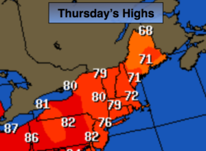
Thursday:
Mostly sunny. Highs in the lower to mid 80s.
Friday:
Sun and clouds. Scattered storms. Humid. Highs in the mid 80s.
Saturday:
An early morning shower, otherwise partly sunny. Highs in the mid 80s.
Sunday:
Mostly sunny. Highs in the lower 80s.
Keep it here for a no nonsense, no hype forecast.