Synopsis:
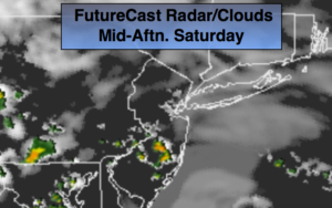
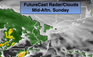
A push of moisture and energy with a stationary front to our South will result in mostly cloudy skies today with spotty showers from time to time. It will not be a washout. Readings will be several degrees below the average of 78º.
An area of steadier and heavier rain will work into parts of central and Southern NJ tonight. Scattered showers are expected elsewhere.
Morning rain will end on Monday otherwise the beginning of the workweek should be pleasant with high pressure taking control over the Northeast with near seasonal conditions.
Stay tuned.
Today:
Clouds will dominate. Spotty showers are possible. Cooler. Highs in the lower 70s. Northeast to Southeast winds at 5-10mph.
Tonight:
Scattered showers. Steadier and heavier rain South of the City. Lows in the upper 50s in City, the lower to mid 50s inland. Northeast winds less than 5mph.
Monday:
Morning rain to the South otherwise becoming mostly sunny. Highs in the mid 70s.
Tuesday:
Partly sunny. Highs in the upper 70s.
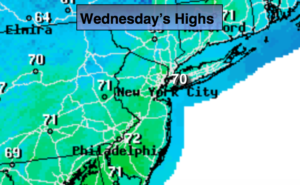
Wednesday:
Partly sunny. A spot shower is possible. Highs in the lower to mid 80s.
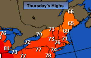
Thursday:
Partly sunny. Highs in the lower 80s.
Keep it here for a no nonsense, no hype forecast.