Synopsis:
The area will be dominated by high pressure the next several days. This will result in dry and progressively warmer temperatures. The sun will rule the sky. It’ll be uncomfortable through midweek. Humidity will come up slowly the next few days. We’ll most likely go into a heat wave. Spotty storms are possible on Wednesday afternoon as a weak cool front approaches.
The lawns will start losing their green hue and become more parched looking through the coming days. We haven’t had rain in over a week.
Our eyes are on the tropics as a strong tropical wave moves through the far Eastern Atlantic.
Stay tuned.
Keep it here for a no nonsense, no hype forecast…
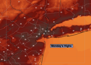
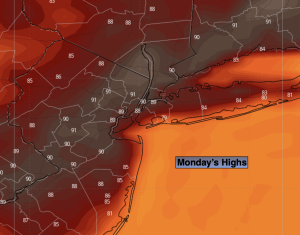
Monday:
Sunny. Hot. Highs around 90º. Southwest winds 5-10mph.
Tonight:
Clear. Lows in the lower 70s in the City, the 60s inland. Light winds.
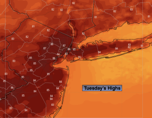
Tuesday:
Hazy, hot and humid. Highs in the lower 90s.
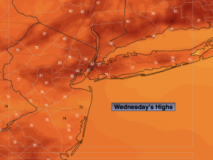
Wednesday:
Hazy, hot and humid. Chance of afternoon spotty storms. Highs in the lower to mid 90s.
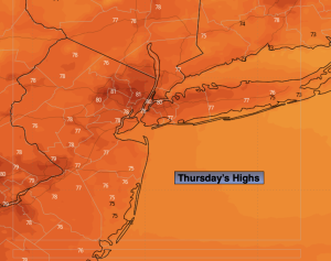
Thursday:
Mostly sunny and very warm. Highs in the upper 80s.
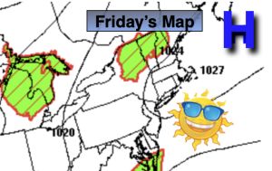
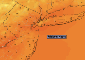
Friday:
Sunny, not as warm. Highs in the mid 80s.