Synopsis:
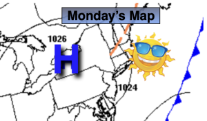
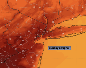
High pressure will basically control our weather through Wednesday. We’ll be 2 for 2 this weekend. Sunday will feature temperatures several degrees above the average high of the upper 70s. Overall bright, pleasant conditions are expected through midweek. The next threat of scattered showers will be on Thursday with a weak disturbance moving up from the South.
Stay tuned.
Keep it here for a no nonsense, no hype forecast.
Sunday:
Partly sunny. Warmer. Highs in the lower 80s. West to North Winds at 5mph.
Tonight:
Mostly clear. Lows in the mid 60s in the City, the 50s inland. Light Winds.
Monday:
Sunny. Highs around 80º.
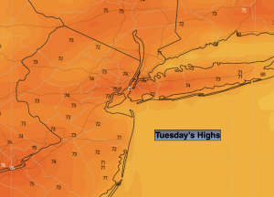
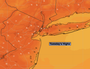
Tuesday:
Sunny. Highs around 80º.
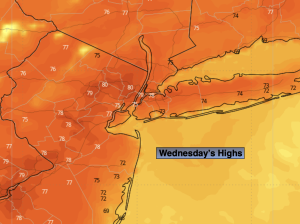
Wednesday:
Mostly sunny. Highs around 80º.
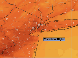
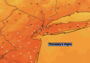
Thursday:
Partly sunny. Chance of a few showers. Highs in the upper 70s.