Synopsis:
Mostly sunny skies are expected through Monday as strong high pressure moves from the Ohio Valley to the Northeast. The flow will be out of Canada which equates to chilly readings. Temperatures will be below the seasonal averages of the lower 60s. Highs will remain in the 50s through the period.
On Tuesday Low pressure will be well off the Southeast coast . A mix of sun and clouds is expected. High pressure over Eastern Canada will keep our skies bright for Wednesday. Another low will be developing over the Ohio Valley on Thursday. The flow around this low will bring a slug of rain up from the South Thursday afternoon and night. The rain should exit the region early Friday morning. Halloween at this time looks dry, breezy and cool.
Stay tuned.
Keep it here for a no nonsense, no hype forecast.
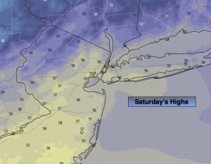
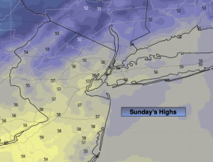
Sunday:
Sun and clouds. Highs in the mid to upper 50s. North winds at 5-10mph.
Tonight:
Clear. Scattered frost inland. Lows in the mid 40s in the City, near freezing inland. Light winds.
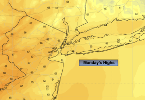
Monday:
Mostly Sunny. Highs in the mid 50s.
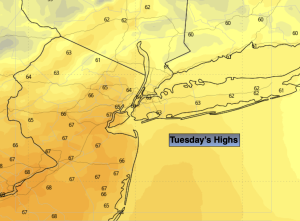
Tuesday:
Sun and clouds. Highs in the mid 50s.
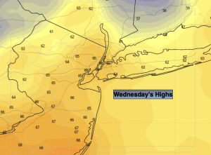
Wednesday:
Partly sunny. Highs in the mid 50s.
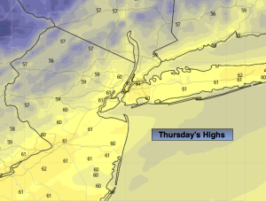
Thursday:
Mostly cloudy with showers. Highs in the upper 50s.