Synopsis:
A shot of cooler air has arrived from the North today under a bright sky. Gusty morning winds will abate during the afternoon.
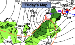
Friday will be bright and cool as high pressure moves offshore.
A few showers are possible Friday night with a front moving in. It now looks that Saturday will be dry and mild. Sunday will feature another system moving in from the West. Showers are possible from mid morning on. Highs will be above the average of the upper 50s.
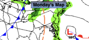
A season changer will arrive on Monday with much colder temperatures. Highs most likely will only be in the upper 40s!
Stay tuned.
Keep it here for a no nonsense, no hype forecast…
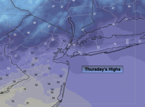
Thursday:
Mostly sunny. Breezy early. Cooler. Highs in the lower 50s. West to Northwest winds at 15-25mph with gusts to 3omph. Winds will abate during the afternoon.
Tonight:
Mostly clear. Cold. Lows around 40º in the City, the upper 20s and 30 inland. Northwest to Southwest winds under 5mph.
Friday:
Partly sunny. Highs in the mid to upper 50s.
Saturday:
Clouds giving way to sun. Mild. Highs in the lower to mid 60s.
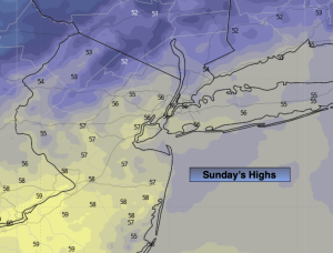
Sunday:
Mostly cloudy with showers developing by mid morning. Highs near 60º.
Monday:
Partly sunny, breezy and colder. Highs in the upper 40s.