Synopsis:
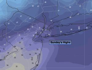
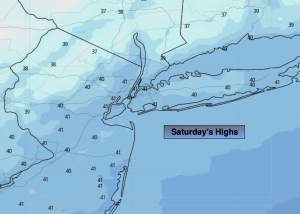
It’ll be a 50/50 split weekend. High pressure will be overhead for Saturday. This will result in mainly sunny skies and chilly readings. Highs will be several degrees below the average high of around 50º. A cool front will approach on Sunday. Spotty morning showers turn to a period of rain during the early afternoon.
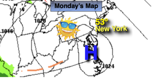
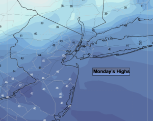
Monday will feature high pressure moving in. Skies will be sunny with below average temperatures.
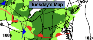
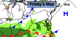
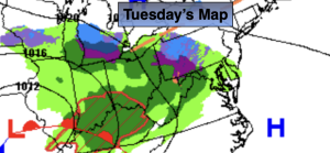
Now to Tuesday. There has been so much chatter about a storm. Yes, there will be low pressure developing over the Southeast. This low will move up and off the our coastline while strengthening. At the onset it will be cold enough for some snow to develop North and West of the I-95 corridor during the mid morning hours. At the coast and in the City it will be all rain. Cold high pressure is lacking to our North. The wind will come off the milder Atlantic waters during the day. Any snow or mix will go over to rain over the nearby suburbs. Well inland a mix of snow and rain will continue. In this region some accumulation is possible, especially over the higher elevations. It is too early to give any amounts for the Northwestern quarter of the tri-state area. We’ll have a better idea by Sunday morning. The storm will pull away Tuesday evening with precipitation coming to an end.
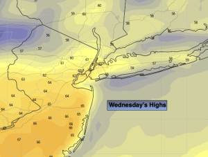
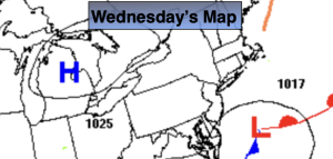
High pressure will build into the region on Wednesday with sunny, chilly conditions.
Stay tuned.
Keep it here for a no nonsense, no hype forecast…
Saturday:
Mostly sunny. Chilly. Highs in the lower 40s. Northwest winds at 10-15mph.
Tonight:
Becoming mostly cloudy. Lows in the upper 30s in the City, the upper 20s inland. Southeast winds at 5-10mph.
Sunday:
Cloudy with morning showers. A period of afternoon rain likely. Highs in the mid 40s.
Monday:
Sunny. Highs in the lower 40s.
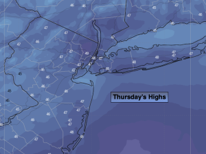
Tuesday:
Rain at the coast. Snow/rain inland. Highs in the lower 40s.
Wednesday:
Sunny. Highs in the lower 40s.