Synopsis:
There will be no change in our stretch of Spring-like readings through Friday. Readings will be ten to twenty degrees above the average high. An April feel will greet us as a strong Southwest flow develops around a Western Atlantic high.
Today will begin with more clouds than sun but the sun will win the battle soon after. It be very warm but no where near the record high of 73º.
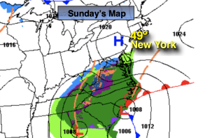
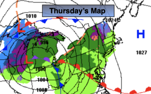
A storm will develop over the Southern plains Thursday morning. It’s warm front will push through our region during the day with scattered showers. It’ll be balmy. The low will move to Montreal, Canada by Friday morning. A cold front will sweep through the region at this time with a period of rain. Morning highs will be Spring-like, then drop during the day.
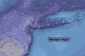
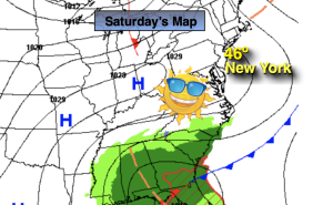
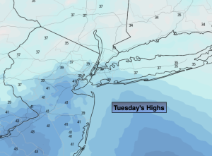
Saturday we’ll finally experience seasonable readings with highs in the lower 40s as cooler high pressure takes hold. The chill won’t last as the high move offshore and the mild return flow greet us for the second half of the weekend.
Stay tuned.
Keep it here for a no hype, no nonsense forecast.
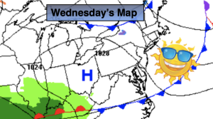
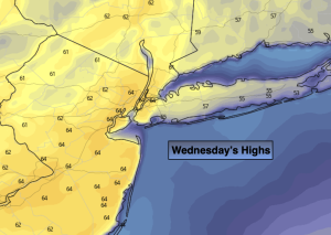
Wednesday:
Clouds to sun. Warm and breezy. Highs in the lower to mid 60s. Cooler over Long Island and the immediate coast. South winds at 8-15mph with gusts to 30mph.
Tonight:
Partly cloudy. Very mild. Lows around 50º along the urban corridor, the 40s inland. Southwest winds at 5-10mph.
Thursday:
More clouds than sun. Warm. Scattered showers. Highs in the lower 60s.
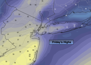
Friday:
Morning rain to sun. Warm to start. Temps will drop during the day. AM highs in the lower 60s.
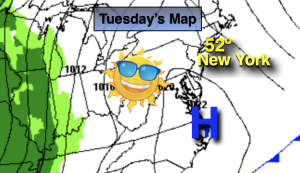
Saturday:
Sunny. Seasonable. High in the lower 40s.
Sunday:
Partly sunny, mild. High around 50º.