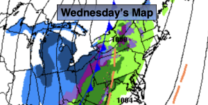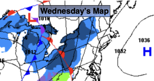
Synopsis:
Wednesday’s readings will struggle to get just above freezing as the core of the cold airmass moves out. Skies will be partly sunny.
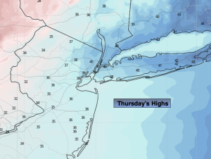
It won’t be as harsh on Thursday as the cold high slips offshore. It’ll actually feel like a heat wave with highs topping 40º!
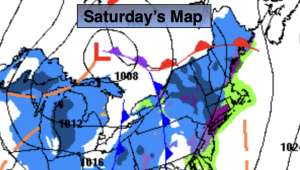
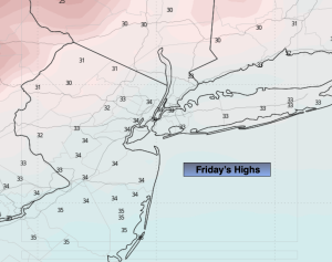
Friday will be colder under a bright sky. Another bitter blast will arrive Friday Night and Saturday as the Canadian Arctic gates are wide open.
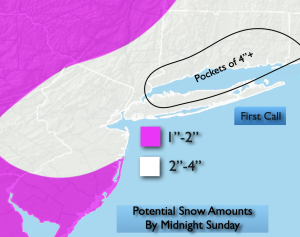
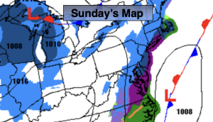
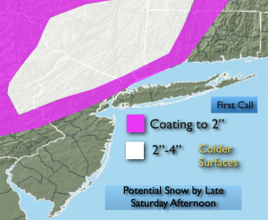
The potential continues to increase for snow Saturday night and Sunday as low pressure to the South collides with a bitter cold high to the North. No specifics are likely for a a couple of days. But a significant accumulation are potentially there for parts of the region.
Stay tuned.
Keep it here for a no nonsense, no hype forecast…
Wednesday:
Partly sunny. Breezy. Not as cold. Highs in the lower 30s. Southwest winds at 10-20mph.
Tonight:
Mostly cloudy. Lows in the lower to mid 30s along the coast, the 20s inland. Southwest winds at 8-12mph.
Thursday:
Mostly sunny. Not as harsh. Highs in the lower 40s.
Friday:
Mostly sunny. Colder. Highs around freezing.
Saturday:
Thickening clouds. Frigid. Highs in the upper teens.
Sunday:
Potential snow. Frigid. Highs in the upper teens.