Synopsis:
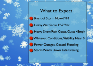
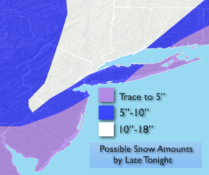
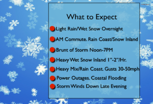
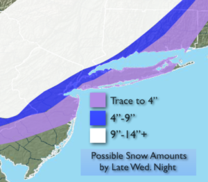
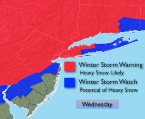
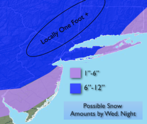
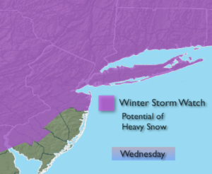
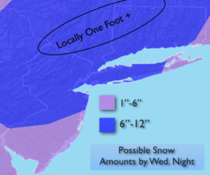
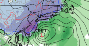
The heavy wet snowstorm that affected much of the tri-state area is pulling out to sea. Any snow will end over Eastern areas tonight. Accumulations varied greatly by location. Some regions only picked up a slushy coating while other locations North and West of the City got over 20″. What a storm.
The low will pull into Eastern Canada the through the end of the week. Readings will be a few degrees below average with a mix of sun and clouds.
By the weekend high pressure will nose in from Canada with more sunshine and just below average temperatures.
A storm will be on the map on Sunday over the Southern states. Will that storm move out the sea to the South or will it take a turn up the coast. There is a low threat of the storm affecting right now. Many days to watch how this unfolds.
Stay tuned.
Tonight:
Snow ending out East by Midnight. Lows near freezing in the City, the upper 20s inland. Northwest wind diminishing to 8-12mph.
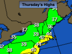
Thursday:
Partly sunny. Highs in the lower to mid 40s. West to Northwest winds at 10-15mph.
Friday:
Partly sunny. Breezy. Highs in the lower to mid 40s.
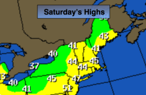
Saturday:
Partly sunny. Breezy. Highs in the lower to mid 40s.
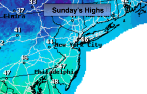
Sunday:
Partly sunny. Highs in the lower to mid 40s.
Monday:
Mostly cloudy. Highs in the lower 40s.
Keep it here for a no nonsense, no hype forecast.