Synopsis:
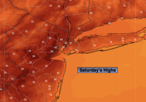
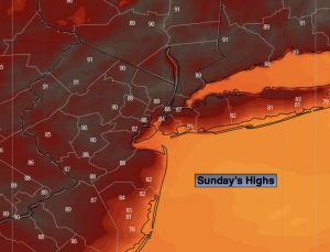
Isolated showers are possible this morning with the passage of a weak cool front. It’ll still be warm with highs in the mid 80s. The sun will dominate during the afternoon.
High pressure over the Midwest will result in a Northwest flow out of Canada through midweek. Temperatures will be cooler than average with abundant sunshine. You can’t ask for better weather in later August!
A weak cool front will approach on Friday with a slight risk of showers. Readings will still be pleasant.
The Labor Day Weekend looks like a winner!
Stay tuned.
Keep it here for a no nonsense, no hype forecast…
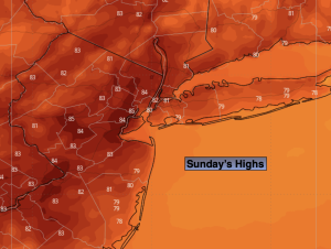
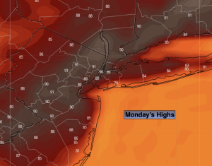
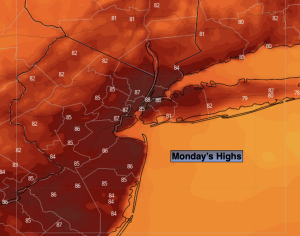
Monday:
Sun and clouds. Isolated morning showers. Warm. Highs in the mid 80s. Southwest to West winds at 5-10mph with gusts to 20mph.
Tonight:
Clear. Cooler. Lows in the lower 60s in the City, the 50s inland. Light winds.
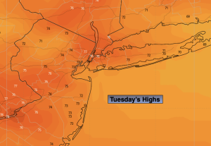
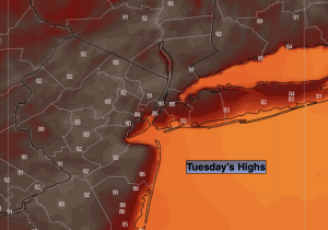
Tuesday:
Mostly sunny. Cooler. Highs in the upper 70s to around 80º.
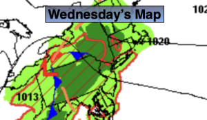
Wednesday:
Sunny. Pleasant. Highs in the mid to upper 70s.
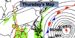
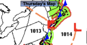
Thursday:
Sunny. Pleasant. Highs in the upper 70s.
Friday:
Sun and clouds. Spotty shower possible. Highs in the upper 70s to around 80º.