Synopsis:
High pressure will basically control our weather the next 5 days. There will be slight fluctuations in temperatures. Overall bright, pleasant conditions are expected. Short and sweet. Enjoy!
Stay tuned.
Keep it here for a no nonsense, no hype forecast.
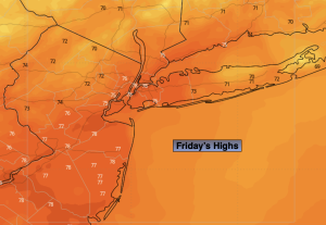
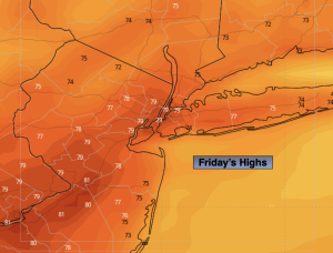
Friday:
Sunny. Pleasant. Highs in the mid to upper 70s. Northeast to Southeast winds at 5-10mph.
Tonight:
Clear and comfortable. Lows in the mid 60s in the City, the 50s inland. North winds at 5mph.
Saturday:
Mostly sunny. Highs in the upper 70s to around 80º.
Sunday:
Partly sunny. Highs around 80º.
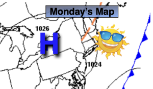
Monday:
Partly sunny. Highs in the mid to upper 70s.
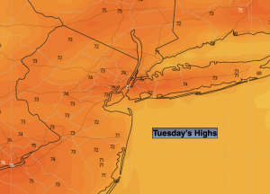
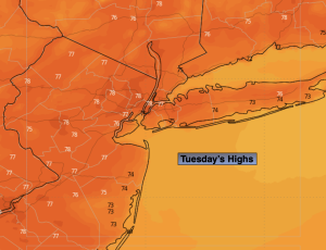
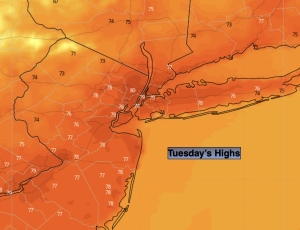
Tuesday:
Partly sunny. Highs in the mid to upper 70s.