Synopsis:
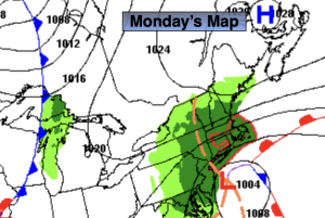
Mostly sunny skies are expected through Monday as strong high pressure moves from the Ohio Valley to the Northeast. The flow will be out of Canada which equates to chilly readings. Temperatures will be below the seasonal averages of the lower to mid 60s. Highs will remain in the 50s through the period.
By Tuesday Low pressure will be developing to the South. Sun will give way to clouds. There has been a lot of chatter about a storm for late next week. The details need to be ironed out as we are more than 5 days away from the possible effects.
Stay tuned.
Keep it here for a no nonsense, no hype forecast.
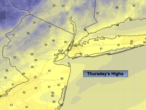
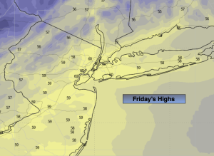
Friday:
Mostly sunny. Cool. Highs in the upper 50s. West to Northwest winds at 8-15mph.
Tonight:
Clear. Lows in the mid 40s in the City, the 30s inland. Northwest winds at 5-10mph.
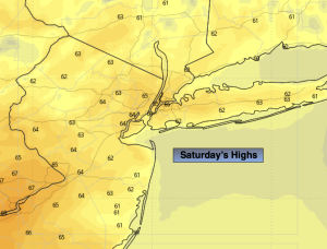
Saturday:
Sunny. Cool. Highs in the mid 50s.
Sunday:
Sunny. Highs in the mid 50s.
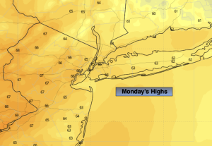
Monday:
Mostly Sunny. Highs in the mid 50s.
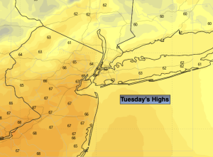
Tuesday:
Sun and clouds. Highs in the mid 50s.