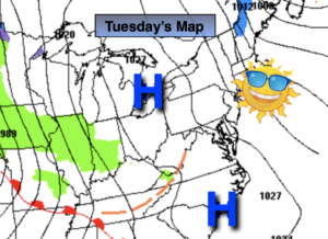
Synopsis:
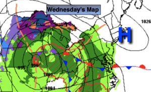
A warm front will approach the area today. Sun will give way to clouds. It won’t be as harsh as recent days. Readings will still be well below the average high of 53º.
For the first time in many nights all area temperatures tonight will be above freezing as the wind blows from the South.
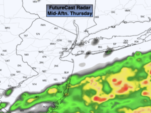
Thursday will feature warm push as readings ahead of a cool front approach 70º! A big change for sure. It’ll be cooler over Long Island and coastal regions. Showers are possible during the late afternoon.
Showers and storms are likely Thursday night.
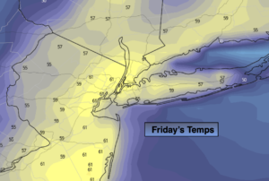
Behind the front on Friday which is the first day of April, it’ll be partly sunny. Winds will increase during the day. Seasonable conditions are expected.
The weekend looks decent at this time.
Stay tuned.
Keep it here for a no hype, no nonsense forecast.
Catch me on the Fox Weather Stream between 10am-1pm today. Find us on Tubi, and YouTube TV and as always the Fox Weather App.
Today:
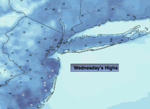
Sun and clouds. Cool. Highs in the mid 40s. Northwest to South winds at 5-10mph.
Tonight:
Cloudy. Milder than recent nights. Lows in the mid 40s in the City, the 30s inland. South to Southeast winds at 5mph.
Thursday:
Mostly cloudy. Much warmer. Showers possible during the afternoon. Highs in the mid 60s to near 70º.
Friday:
Partly sunny and mild. Becoming windy. Highs in the upper 50s.
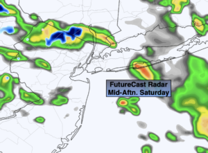
Saturday:
Sun and clouds. Seasonable. Highs in the mid 50s.
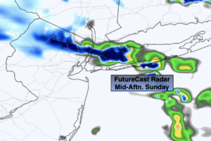
Sunday:
Clouds to sun. Highs in the mid 50s.