Synopsis:
The stationary front (the cause of the grey, damp days of the past week) will become a warm front and move toward the area today. Periods of rain is expected with locally heavy downpour; it’ll be unseasonably cool.
The warm front will move through tonight. Scattered showers are expected. Sunday looks to be the warmer with scattered showers. The sun will make appearance!
The workweek starts off with plenty of sun and warm readings as high pressure moves in.
Stay tuned
Today:
Cloudy with periods of rain. Locally heavy downpours. Highs in the lower to mid 60s. East winds at 8-12mph.
Tonight:
Scattered showers. Temperatures will actually rise through the 60s. Southwest wind at 5-10mph.
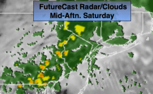
Sunday:
Clouds will give way to partly sunny skies. A few showers are possible. Much warmer. Highs in the upper 70s.
Monday:
Partly sunny. Highs near 80º.
Tuesday:
Mostly cloudy. Scattered showers. Highs in the lower 70s.
Wednesday:
Mostly sunny. Highs in the mid to upper 70s.
Keep it here for a no nonsense, no hype forecast.