Synopsis:
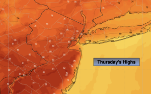
High pressure over the East coast will continue to dominate our weather as we turn the calendar page to October. It won’t feel like the new month as readings will flirt or top 80º in many areas Thursday and Friday. A mix of sun and clouds is expected. A few showers are possible later Friday afternoon as a cool front moves in.
The first weekend of October will feature more seasonal temperature as high pressure from the North influences our region. Abundant sunshine is expected for Saturday. More clouds will move in Sunday. A weak disturbance looks to ride along a frontal boundary to our South. The potential is there for some light rain or showers later Sunday. This isn’t etched in stone at this time.
It’ll be a nice start to Monday with plenty of sun and average temperatures for this time of the year.
Stay tuned.
Keep it here for a no nonsense, no hype forecast…
Tonight:
Partly cloudy. Lows in the lower to mid 60s in urban areas. The upper 50s inland. Light Southwest wind,
Thursday:
Partly sunny. Warm. Highs in the 70s to around 80º inland. Cooler at the coast. Southwest winds at 5-10mph.
Friday:
Partly sunny. Warm. Chance of a late day shower. Highs in the lower 80s.
Saturday:
Mostly sunny. More seasonal. Highs around 70º.
Sunday:
Sun and clouds. Chance of late day showers. Highs in the mid to upper 60s.
Monday:
Mostly sunny. Pleasant. Highs in the upper 60s.