Synopsis:
A cool front will pass through the region today. There’s not much associated the front but a stray storm can’t be ruled out. The one thing the front will do is knock down the humidity during the afternoon.
Friday will be much less humid as a flow from Canada takes hold by afternoon. A mix of sun and clouds is expected.
The better of the two days of the weekend will be Saturday. It will be refreshing under a sunny sky. Sunday will feature sun giving way to some clouds. Scattered afternoon showers and storms are possible as a warm front approaches.
On Monday a cool front will move through during the morning bringing an end to the early morning showers.
Stay tuned.
Keep it here for a no nonsense, no hype forecast….
Thursday:
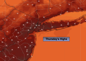
Partly sunny. Highs in the mid to upper 80s. Northwest winds at 5-10mph.
Tonight:
Mostly clear. Lower humidity. Lows in the 60s throughout. Northwest winds at 5mph.
Friday:
Partly sunny. Not as warm and less humid. Highs in the lower to mid 80s.
Saturday:
Sunny. Low humidity. Highs in the lower 80s.
Sunday:
Sun to afternoon clouds. Scattered showers and storms are possible. Highs in the mid 80s.
Monday:
Partly sunny. Highs in the mid to upper 80s.