Synopsis:
High pressure will influence our weather today. It will be pleasant with temperatures several degrees below the average high of 70º.
Midweek will feature a cool front approaching the region. Any sun Wednesday will give way to clouds and possible late afternoon showers. The shower threat will continue into Thursday as the system moves offshore. Below average temperatures will continue.
Friday should feature more sun, but a spotty shower can’t be ruled out behind the departing low.
Saturday will be the mildest day of the next five with readings reaching into the 70s.
Stay tuned.
Keep it here for a no nonsense, no hype forecast…
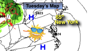
Tuesday:
Sunny. Pleasant. Highs in the mid 60s. North to Southwest winds at 5-10mph.
Tonight:
Partly cloudy. Lows in the lower 50s in the City, the 40s inland. South winds at 5-10mph.
Wednesday:
Mostly cloudy. Chance of late afternoon showers. Highs in the mid 60s.
Thursday:
Mostly cloudy. Scattered showers possible. Highs in the mid 60s.
Friday:
Partly sunny. Spotty afternoon shower. Highs in the mid to upper 60s.
Saturday:
Partly sunny. Milder. Highs in the mid 70s.