Synopsis:
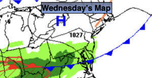
Mostly cloudy skies are expected today. The sun may make an appearance. It will be dry as high pressure nosed in from the North. Readings will be slightly above the average high of the mid 40s.
Tonight will be cloudy. Showers will develop late.
A warm front will approach Thursday with periods of rain.
It’ll still be unsettled Friday with a stationary front just to our South. Showers are likely during the morning. Cloudy skies will remain for the afternoon.
On Saturday a Southwest wind should prevail around a Western Atlantic high. This should result in a boost in temperatures. A cool front will move through Sunday morning with a few showers. The sun will return and it’ll be mild.
We “Spring Ahead” this Sunday. Set the clocks ahead one hour Sunday at 2am as Daylight Saving Time begins. The sun will set an hour later. Yes! It’s also a good time to check the batteries in your smoke and carbon monoxide detectors.
Stay tuned.
Keep it here for a no nonsense, no hype forecast…
Wednesday:
Mostly cloudy. Highs near 50º. North winds at 5mph.
Tonight:
Cloudy. Showers late. Lows around 40º in the City, near freezing North and West. Northeast winds less than 5mph.
Thursday:
Periods of rain. Highs in the mid 40s.
Friday:
Morning showers. Remaining mostly cloudy. Highs in the upper 40s.
Saturday:
Clouds, some sun. Milder. Highs in the upper 50s.
Sunday:
A morning shower, otherwise becoming party sunny. Mild. Highs in the lower 60s.