Synopsis:
A stationary front will be over the region today. On and off light rain, drizzle and fog is expected.
A mix of clouds and sun is expected on Thursday along with seasonal readings as the region will be in between systems.
Friday will be unsettled as weak low pressure scoots to our South. Some rain is likely. A potential mix exists for Northern areas.
Clouds will continue to dominate on Saturday as weather systems remain weak over the region.
Now to Sunday. All of the computer models show an East coast storm developing. The storm’s track is in question. If it goes up the coast close enough to the region a significant snow is likely. If the storm tracks far enough offshore minor effects will be had. The latest models have the storm farther offshore. The potential event is four days away. Much can change and evolve in that time span. This hype has happened way too many times this Winter. Have we learned anything from the past? At this time the potential for some snow is in the forecast. Please stay tuned to the forecast and only follow credible meteorologists.
Keep it here for a no nonsense, no hype forecast…
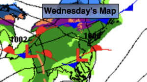
Wednesday:
On and off light rain and fog. Highs in the lower 40s. Northeast winds at 5mph.
Tonight:
Areas of light rain early. Mostly cloudy. Lows in the lower to mid 30s throughout. Northeast winds at 5-10mph.
Thursday:
Mostly cloudy. Highs in the lower to mid 40s.
Friday:
Areas of rain. A mix possible North & West. Highs around 40º.
Saturday:
Mostly cloudy. Highs in the lower 40s.
Sunday:
Potential for some snow. Highs in the mid to upper 30s.