Synopsis:
Christmas Eve will feature mostly sunny skies as high pressure slides in from the Great Lakes. It will be brisk.
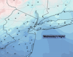
Christmas Day is looking dry at this time under a mostly cloudy sky. Temperatures will be close to the average high for the holiday. The average high is in the lower 40s.
Low pressure will move from the Midwest to off the Mid-Atlantic coast Friday and Friday night. The latest computer guidance suggests that high pressure over Southeastern Canada will supply enough cold air for the potential of accumulating snow Friday late afternoon and night. A mix is possible over central and Southern areas. Confidence continues to increase. A few to several inches of snow is possible. We’ll continue to monitor the latest guidance and have a clearer picture shortly.
Any precipitation on Saturday will taper off during the afternoon hours. Skies will remain cloudy.
A cold front will approach Sunday. The day will start off dry. A mix to rain is possible for Northern areas during the afternoon Sunday. Showers are expected elsewhere.
Stay tuned.
Keep it here for a no nonsense, no hype forecast…
Christmas Eve:
Mostly sunny. Breezy. Highs in the lower 40s. Northwest winds at 15-30mph with gusts to 35mph in the morning.
Tonight:
Partly cloudy. Lows around freezing in the City, near 20º inland. Northwest diminishing winds becoming Southwest less than 5mph.
Christmas Day:
Mostly cloudy. Highs in the lower 40s.
Friday:
Snow/mix potential by late afternoon. Highs around freezing.
Saturday:
AM light snow/mix tapers off during the afternoon. Remaining mostly cloudy. Highs in the mid 30s.
Sunday:
Mostly cloudy. Mix possible North during the afternoon, showers elsewhere. Highs in the mid 40s.