Synopsis:
The first full day of Fall will feel more like Summer. Readings flirt with 80º as a Southwest wind brings up the warmth. A late day shower can’t be ruled out.
Wednesday will feature a mix of sun and clouds. A few showers are possible as a moist flow develops off the ocean.
Thursday will be unsettled. A stationary front will be draped along the East coast. On and off showers are likely. Readings will be cooler.
On Friday the front will have pushed far enough offshore that any morning showers should give way to some sun. It’ll be milder.
Saturday will feature weak high pressure over the region. A mix of sun and clouds is expected along with above average temperatures.
Stay tuned.
Keep it here for a no nonsense, no hype forecast.
Tuesday:
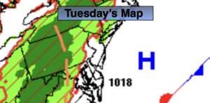
Partly sunny. Warm. Chance of a late day shower. Highs near 80º. Southwest winds at 5-10mph.
Tonight:
Mostly cloudy. Spotty shower. Lows in the mid 60s in the City, near 60º inland. Southwest winds at 5mph.
Wednesday:
Mostly cloudy. Spotty showers. Highs in the mid 70s.
Thursday:
Cloudy. Showers likely. Cooler. Highs in the lower to mid 70s.
Friday:
Chance of morning showers. Clouds to some sun. Highs in the mid to upper 70s.
Saturday:
Sun and clouds. Mild. Highs in the upper 70s.