Synopsis:
Today will feature plenty of sun and warm readings. An upper level low over New England will spark a few scattered showers and storms during the afternoon and evening. Any of these scattered storms could produce gusty winds, hail and torrential rain. The greatest threat will be North and East of the City.
Tuesday will be a typical late August day as high pressure dominates. Mainly sunny skies are anticipated with just above average highs. The average high is in the lower 80s.
A hot push of air will arrive on Wednesday. Readings will get into the 90s and humidity levels will be high. The heat index will approach 100º along the urban corridor. A few storms will develop later in the day and evening as a cool front approaches. This front will be a season changer on Thursday and Friday. High pressure from Canada will bring down much cooler and drier air!
Stay tuned.
Keep it here for a no nonsense, no hype forecast.
Monday:
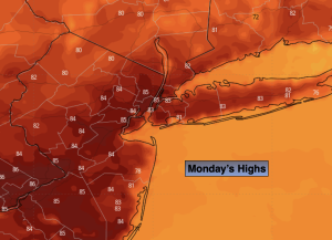
Mostly sunny. Chance of afternoon scattered showers and storms. Highs in the mid 80s. Northwest to South winds at 5-10mph.
Tonight:
An evening spotty storm, otherwise mostly clear with patchy fog. Lows around 70º in the City, the 50s inland. Southeast to Northeast winds less than 5mph.
Tuesday:
Mostly sunny. Highs in the mid 80s.
Wednesday:
Hazy, hot and humid. Scattered late day and evening storms. Highs in the lower to mid 90s. Heat index near 100º in spots.
Thursday:
Partly sunny. Much cooler. Highs in the mid to upper 70s.
Friday:
Mostly sunny. Pleasant. Highs in the mid 70s.