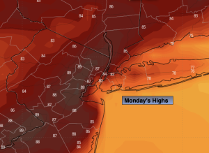
Synopsis:
The most comfortable day of the upcoming week will be today. A heat wave will most likely start on Tuesday (readings of 90º or higher) and continue through the week. Extensive high pressure both at the surface and aloft will dominate our area through the coming days.
The first heat wave is the most taxing on the body. Please drink plenty of fluids and stay out of the direct sun, if possible.
Stay tuned.
Keep it here for a no nonsense, no hype forecast.
Monday:
Sunny. Warmer. Highs in the mid 80s. South winds at 8-15mph.
Tonight:
Clear. Lows in the lower 70s in the City, the 60s inland. Light Southwest winds.
Tuesday:
Hazy and hot. Highs in the lower 90s.
Wednesday:
Hazy, hot and humid. Highs in the mid 90s.
Thursday:
Hazy, hot and humid. Highs in the mid to upper 90s.
Friday:
Hazy, hot and humid. Highs in the upper 90s.