

Synopsis:
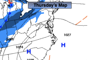
Thursday will feature high pressure over the Southeast. A more temperate flow around this system should have readings flirting with freezing along the urban corridor. Any morning sun will give way to increasing clouds.
Clouds will thicken tonight with all readings below freezing.
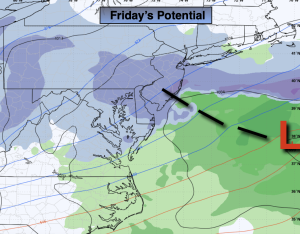
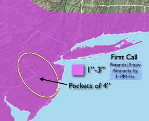
Now to Friday’s snow-low pressure will develop offshore. How close does this happen to the coast and where does the surface trough setup will determine who gets what in terms of snowfall. Where that axis sets up with the trough will be where the maximum snowfall occurs. The guidance has areas to the North seeing the least with areas to the South of the City receiving the highest accumulations. The thinking is a light event here- a possible 1″-3″ for the region. Inland central & Southern NJ may find a few spots near or over 4″. The snow will start Friday morning between 7-9am and continue throughout the day.
Saturday will be frigid as an Arctic blast makes a visit. Readings will only be in the 20s. The windchills will be quite low.
Sunday readings under abundant sunshine should recover to around freezing.
We’ll be out of the freezer on Monday as the high moves off the coast and a milder flow takes hold.
Keep it here for a no nonsense, no hype forecast.
Thursday:
Increasing clouds. Highs around freezing. West to Southwest winds at 8-12mph.
Tonight:
Cloudy. Lows in the upper 20s along the urban corridor, the upper teens and 20s inland. Winds becoming North at 5mph.
Friday:
Light snow likely. Highs around 30º.
Saturday:
Partly sunny, windy and frigid. Highs in the 20s.
Sunday:
Sunny. Highs around freezing.
Monday:
Sunny. Highs in the mid to upper 30s.