Synopsis:.
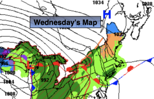
A warm front will stall and become stationary today just to our South. This will result in complete turnaround in the weather from 24 hours earlier. The wind will blow off the cold Atlantic resulting in a grey day with much cooler temperatures and times of drizzle.
Passover begins at sundown today which occurs at 7:25EDT. Happy Passover!
Another 360º turn in the weather will occur on Thursday. Readings will feel like early June! Highs will be more than twenty degrees warmer than Wednesday as high pressure moves off the coast and a Southwest flow will take hold. A mix of sun and clouds is expected with a chance of scattered late afternoon and evening showers as a cool front approaches.
More seasonable readings (the upper 50s) are expected on Friday into Easter weekend as strong high pressure dominates the Northeast. A delightful holiday weekend is on the way. Some may call it egg-cellent!
Stay tuned.
Keep it here for a no nonsense, no hype forecast.
Wednesday:
Cloudy. Much cooler. Intermittent drizzle. Highs in the upper 40s and lower 50s. Northeast to East winds at 8-15mph.
Tonight:
Cloudy. Intermittent drizzle. Lows in the upper 40s to mid 50s. East to South winds at 5mph.
Thursday:
Sun and clouds. Warm. Chance of afternoon scattered showers. Highs in the mid to upper 70s.
Friday:
Mostly sunny. More seasonable. Highs in the mid to upper 50s.
Saturday:
Sunny. Highs in the mid 50s.
Easter:
Sunny. Highs in the upper 50s.