Synopsis:
Cold high pressure will work into the region today. Readings will get just above freezing in urban areas and remain in the 20s to around freezing inland.
Tonight will be a typically cold night for this time of the year.
Sunday will feature a mix of sun and clouds with seasonal readings (average high is 43º).
An Arctic front will move in Monday with readings remaining in the 20s to around freezing despite the sunshine.
March will come in like a lamb on Tuesday. It won’t be as harsh under a mix of sun and clouds. High pressure will dominate midweek with near seasonal readings.
Stay tuned.
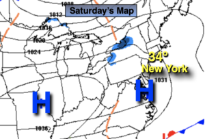
Saturday:
Clouds and sun. Cold. High in the mid 30s. Northwest to West winds at 5-10mph.
Tonight:
Clear. Lows around 30º in the City, the teens and 20s inland. West winds at 5-10mph.
Sunday:
Partly sunny. Seasonal. High in the lower to mid 40s.
Monday:
Sunny. Quite cold. High near 30º.
Tuesday:
Mostly sunny. High in the lower 40s.
Wednesday:
Partly sunny. High in the mid 40s.