Synopsis:
Our cool August weather will continue the next couple of days as high pressure moves from our area to off the New England coast. This will keep temperatures below average and humidity levels low by August standards. A stationary front and moisture moving up from the South will result in a mainly cloudy sky today and Wednesday. The latest computer model have sped up the potential for showers (mainly at the coast). It now looks like showers are possible on Wednesday. Inland areas should remain rain-free.
The coastal showers should end early Thursday morning East, otherwise the sun should return as the system moves offshore.
Friday looks like a winner. It’ll be bright and seasonal with readings in the lower to mid 80s.
The weekend looks warm and sunny as a more typical pattern for August begins to setup as high pressure builds along the East coast.
Keep it here for a no nonsense, no hype forecast.
Tuesday:
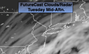
Mostly cloudy. Comfortable. Highs in the upper 70s. North to Southeast winds at 5-10mph.
Tonight:
Mainly cloudy. Lows in the mid 60s in urban areas, the 50s inland. Light and variable winds.
Wednesday:
Mostly cloudy. Showers possible, mainly along and East of I-95. Highs in the mid to upper 70s.
Thursday:
An early morning shower East, otherwise becoming partly sunny. Highs in the upper 70s.
Friday:
Partly sunny. Warmer. Highs in the mid 80s.
Saturday:
Partly sunny. Highs in the mid 80s.