Synopsis:
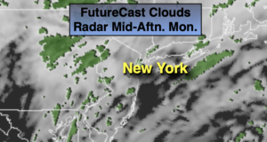
Scattered showers and areas of drizzle are likely through this morning as low pressure moves off the North Carolina coast. Skies will remain mostly cloudy for the afternoon.
Tonight will be mainly cloudy. A spot shower can’t be ruled out.
Tuesday and Wednesday will feature a cool front just to our North and West. This front will washout and lose much of its moisture. The sun should win the battle with the clouds both days. It will feel good to get some sunshine in here. Temperatures will be near the average high of 60º.
Tropical system Zeta will make landfall over the Northern Gulf coast states midweek. This remnants will move up the Piedmont and result in a rainy day on Thursday into Friday morning.
Stay Tuned.
Keep it here for a no nonsense, no hype forecast.
Today:
Cloudy with scattered showers and patchy morning drizzle. Remaining cloudy during the afternoon. Highs in the upper 50s. Northeast winds at 5-10mph.
Tonight:
Mostly cloudy with a spot shower possible. Lows in the lower 50s in the City, the upper 40s inland. Winds becoming Northwest at 5mph.
Tuesday:
Clouds and sun. Highs around 60º.
Wednesday:
Partly sunny. Highs around 60º.
Thursday:
Rain likely. Highs in the upper 50s.
Friday:
Morning rain. Some afternoon sun. Very cool. Highs in the upper 40s.