Synopsis:.
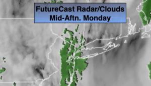
A coastal storm will move from the off the Mid-Atlantic coast to off the New England today. On and off areas of drizzle and showers is expected. There will be dry times. Minor coastal flooding may occur during times of high tide through this evening. The high pressure over the Canadian maritimes and the coastal storm will create rough seas.
As an upper level low will swing by tonight. A steadier light rain is expected. It maybe cold enough well North and West for the rain to mix with snow. The highest elevations may see a coating.
Early morning clouds Tuesday will give way to sunshine. A bright day is expected for Wednesday and Thursday as high pressure moves in from the West. Temperatures will remain below normal then rise to near seasonal averages by Thursday.
A cold front will approach Friday. Ahead of it it’ll be in the 50s with readings dropping during the afternoon. A few spotty showers are possible.
Stay Tuned.
Keep it here for a no hype, no nonsense forecast.
Today:
On and off showers and drizzle. Highs in the lower to mid 40s. North winds at 10-20mph.
Tonight:
A period of light rain. The rain may mix with a change to wet snow late well North and West. Lows in the 30s throughout. Northwest winds at 5-10mph.
Tuesday:
Morning clouds, otherwise skies will be partly sunny. Highs around 50º.
Wednesday:
Mostly sunny. Highs around 50º.
Thursday:
Mostly sunny. Highs in the lower 50s.
Friday:
Sun and clouds. Spotty showers. Highs in the mid 50s. Temperatures falling during the afternoon.