Synopsis:
Once again we’ll be near freezing today along with a mix of sun and clouds as high pressure dominates.
On Friday, a cold front will be approaching. Sun will give way to clouds. Scattered snow showers are possible in the evening and at night. It doesn’t look to be a big deal. An inch of snow may fall in spots by Saturday AM. The big deal will be the Arctic blast that will arrive this upcoming weekend. Temperatures will only be in the teens with a biting wind and dangerous wind chill. Sigh…
Stay tuned.
Keep it here for a no nonsense, no hype forecast…..
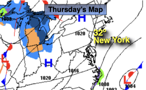
Thursday:
Mostly sunny. Highs around 30º. North to Northwest winds at 5-10mph.
Tonight:
Partly cloudy. Lows around 20º along the coast, the single digits and teens inland. North winds 5-10mph.
Friday:
Sun to clouds. Scattered snow showers possible during the evening. Highs around 30º.
Saturday:
Mostly sunny, windy and bitterly cold. Highs around 20º. Wind chills near 0º.
Sunday:
Mostly sunny, windy and bitterly cold. Highs in the upper teens. Wind chills near 0º.
Monday:
Partly sunny. Still cold. Highs in the mid to upper 20s.